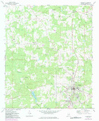
1971 Map of Lafayette
USGS Topo · Published 1984About this map
Lafayette serves as the focal point of this Chambers County landscape, its street grid and public infrastructure clearly defined at the junction of the Central Of Georgia railroad. The town's social fabric is illustrated by numerous local institutions, including Eastside Sch, Southside Sch, and the Batson Memorial Sanitarium to the north. Beyond the town limits, the terrain is shaped by a dense network of drainage, most notably Chatahospee Creek and Mill Creek, which flow toward the Lafayette Reservoir. Small agricultural and rural communities like White Plains, Rollins, and Marcot are scattered throughout the region, each anchored by local landmarks such as Rock Springs Ch and Sandy Ridge Ch. The 1980s photorevisions highlight evolving land use, while original features like the Gravel Pit and numerous small cemeteries, such as Finley Cem, provide a detailed record of local industry and genealogy.
Find a feature on this map
36 named features on this map. Tap any name to fly to it.
Don’t see what you’re looking for? This feature index may not catch every label — zoom into the map to look around manually.
Map Details
Editions of this 1971 Lafayette Map
2 editions found
Other maps of this area

1891 · Ashland
USGS Topo · 1:125,000

1899 · Wedowee
USGS Topo · 1:125,000

1902 · Wedowee
USGS Topo · 1:125,000

1906 · Dadeville
USGS Topo · 1:125,000

1907 · Opelika
USGS Topo · 1:125,000

1909 · Opelika
USGS Topo · 1:125,000

1953 · Atlanta
USGS Topo · 1:250,000

1955 · Phenix City
USGS Topo · 1:250,000

1957 · Phenix City
USGS Topo · 1:250,000

1957 · Atlanta
USGS Topo · 1:250,000