
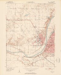
1950 Map of Lafayette
USGS Topo · Published 1952About this map
The Wabash River divides the academic and residential landscapes of mid-century Tippecanoe County, where Purdue University anchor the heights of West Lafayette. This 1950 revision illustrates the expanding footprint of the university, featuring the Stadium and the Purdue Airport south of the main campus. Across the river, the city of Lafayette is shown in detail, from the rail corridors of the New York Central to the dense neighborhood streets like Kossuth St and Underwood St.
Find a feature on this map
66 named features on this map. Tap any name to fly to it.
Don’t see what you’re looking for? This feature index may not catch every label — zoom into the map to look around manually.
Map Details
Editions of this 1950 Lafayette Map
2 editions found
Other maps of this area

1941 · Lafayette
USGS Topo · 1:24,000

1942 · Otterbein
USGS Topo · 1:24,000

1942 · Lafayette
USGS Topo · 1:24,000

1951 · Otterbein
USGS Topo · 1:24,000

1953 · Danville
USGS Topo · 1:250,000

1955 · Danville
USGS Topo · 1:250,000

1956 · Danville
USGS Topo · 1:250,000

1961 · Romney
USGS Topo · 1:24,000

1961 · Stockwell
USGS Topo · 1:24,000

1961 · Lafayette East
USGS Topo · 1:24,000