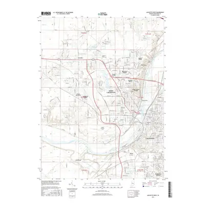
2016 Map of Lafayette West
USGS Topo · Published 2016About this map
West Lafayette and the sprawling Purdue Univ-Main Campus dominate this 2016 record of Tippecanoe County. The landscape is defined by the sweeping curve of the Wabash River, which separates the two primary urban centers while supporting a complex network of transportation infrastructure. To the west, the Purdue University Airport serves as a major landmark, surrounded by residential developments like McQuinn Estates and Green Meadows.
Find a feature on this map
272 named features on this map. Tap any name to fly to it.
Don’t see what you’re looking for? This feature index may not catch every label — zoom into the map to look around manually.
Map Details
Editions of this 2016 Lafayette West Map
This is the sole edition of this map. No revisions or reprints were ever made.
Other maps of this area

1941 · Lafayette
USGS Topo · 1:24,000

1942 · Otterbein
USGS Topo · 1:24,000

1942 · Lafayette
USGS Topo · 1:24,000

1950 · Lafayette
USGS Topo · 1:24,000

1951 · Otterbein
USGS Topo · 1:24,000

1953 · Danville
USGS Topo · 1:250,000

1955 · Danville
USGS Topo · 1:250,000

1956 · Danville
USGS Topo · 1:250,000

1961 · Romney
USGS Topo · 1:24,000

1961 · Stockwell
USGS Topo · 1:24,000