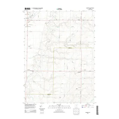
2013 Map of Lagrange
USGS Topo · Published 2013About this map
Lagrange and Litchfield anchor this 2013 landscape, where the agricultural character of Lorain and Medina counties is documented through family farms and local infrastructure. The transition from the rural village of Belden to the township centers reveals a pattern of settlement defined by waterway drainage systems like the East Branch Black River and Center Cr. Local history is preserved in numerous burial grounds, including Litchfield Center Cem and the Aldrich Cem, providing vital reference points for genealogical research. The presence of the Preston Oil Field in the southern portion of the sheet indicates ongoing resource extraction alongside established agricultural operations such as Blue Barn Farms and Kruggel Farms. Aviation history in the region is also represented by both Lagrange Airport and Kruggel Airport, which serve this pocket of northern Ohio.
Find a feature on this map
66 named features on this map. Tap any name to fly to it.
Don’t see what you’re looking for? This feature index may not catch every label — zoom into the map to look around manually.
Map Details
Editions of this 2013 Lagrange Map
This is the sole edition of this map. No revisions or reprints were ever made.
Other maps of this area

1901 · Oberlin
USGS Topo · 1:62,500

1902 · Berea
USGS Topo · 1:62,500

1903 · Oberlin
USGS Topo · 1:62,500

1904 · Berea
USGS Topo · 1:62,500

1904 · Medina
USGS Topo · 1:62,500

1904 · Wellington
USGS Topo · 1:62,500

1906 · Medina
USGS Topo · 1:62,500

1906 · Wellington
USGS Topo · 1:62,500

1950 · Cleveland
USGS Topo · 1:250,000

1953 · West View
USGS Topo · 1:24,000