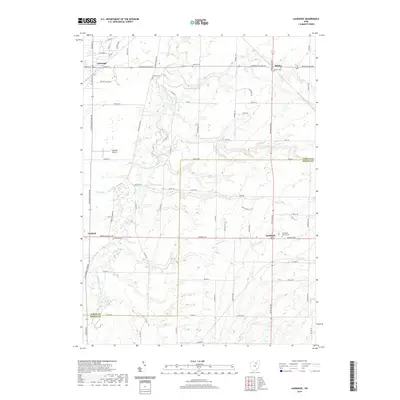
2019 Map of Lagrange
USGS Topo · Published 2019About this map
Lagrange serves as the primary residential hub in this corner of Lorain and Medina counties, characterized by a grid of streets including N Center St and U S Grant St. The surrounding landscape is a pastoral mix of agricultural fields and woodlands, carved by the winding course of the East Branch Black River and smaller tributaries like Salt Creek and Crow Creek. Local history is preserved in a high concentration of small burial grounds scattered throughout the townships, such as Aldrich Cemetery and Knowles Cemetery. The area maintains its small-town character with settlements like Litchfield, Belden, and Penfield serving as quiet crossroads. Modern infrastructure is represented by the Lagrange Airport and a network of county roads like Lagrange Belden Road, which connect these rural communities across the county line.
Find a feature on this map
47 named features on this map. Tap any name to fly to it.
Don’t see what you’re looking for? This feature index may not catch every label — zoom into the map to look around manually.
Map Details
Editions of this 2019 Lagrange Map
This is the sole edition of this map. No revisions or reprints were ever made.
Other maps of this area

1901 · Oberlin
USGS Topo · 1:62,500

1902 · Berea
USGS Topo · 1:62,500

1903 · Oberlin
USGS Topo · 1:62,500

1904 · Berea
USGS Topo · 1:62,500

1904 · Medina
USGS Topo · 1:62,500

1904 · Wellington
USGS Topo · 1:62,500

1906 · Medina
USGS Topo · 1:62,500

1906 · Wellington
USGS Topo · 1:62,500

1950 · Cleveland
USGS Topo · 1:250,000

1953 · West View
USGS Topo · 1:24,000