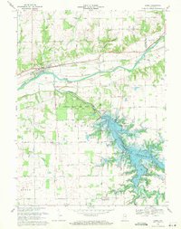
1969 Map of Lagro
USGS Topo · Published 1971About this map
The Wabash River and Salamonie River converge in this Indiana landscape, where the late 1960s saw the transformative presence of the Salamonie Reservoir. The reservoir's vast reach has created several managed landscapes, including the Dora-New Holland State Recreation Area and Mount Hope State Recreation Area. Near the town of Lagro, the Norfolk and Western railway follows the river valley, passing historical sites like the St Patricks Cem.
Find a feature on this map
41 named features on this map. Tap any name to fly to it.
Don’t see what you’re looking for? This feature index may not catch every label — zoom into the map to look around manually.
Map Details
Editions of this 1969 Lagro Map
3 editions found
Other maps of this area

1950 · Lagro
USGS Topo · 1:24,000

1950 · Andrews
USGS Topo · 1:24,000

1950 · Mount Etna
USGS Topo · 1:24,000

1951 · Mount Etna
USGS Topo · 1:24,000

1951 · Andrews
USGS Topo · 1:24,000

1951 · Lagro
USGS Topo · 1:24,000

1952 · Wabash
USGS Topo · 1:24,000

1953 · La Fontaine
USGS Topo · 1:24,000

1953 · Somerset
USGS Topo · 1:24,000

1953 · Muncie
USGS Topo · 1:250,000