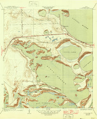
1936 Map of Laguna Vista
USGS Topo · Published 1946About this map
Laguna Madre and the expansive waters of Bahia Grande define this coastal landscape of South Texas during the mid-1940s. The map illustrates a complex network of low-lying ridges and islands, such as Redhead Ridge and Bird Island, which shaped the early transportation routes across the wetlands. Inland from the Gulf, the settlement of Laguna Vista appears near the junction of the Rio Grande Valley road and the Port Isabel Road, serving as a focal point for the region's developing infrastructure.
Find a feature on this map
30 named features on this map. Tap any name to fly to it.
Don’t see what you’re looking for? This feature index may not catch every label — zoom into the map to look around manually.
Map Details
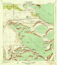
Editions of this 1936 Laguna Vista Map
3 editions found

Other maps of this area

1929 · La Coma
USGS Topo · 1:24,000

1929 · Palmito Hill
USGS Topo · 1:24,000

1929 · Point Isabel
USGS Topo · 1:24,000

1929 · Laguna Vista
USGS Topo · 1:24,000

1930 · Padre Island No. 1
USGS Topo · 1:24,000

1930 · Los Fresnos
USGS Topo · 1:24,000

1930 · Laguna Atascosa
USGS Topo · 1:24,000

1930 · East Brownsville
USGS Topo · 1:24,000

1934 · Port Isabel
USGS Topo · 1:31,680

1934 · La Coma
USGS Topo · 1:31,680