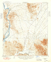
1929 Map of Laguna
USGS Topo · Published 1949About this map
The Colorado River and Gila River meet in a landscape defined by desert mining and early river management. This survey highlights the Silver District and the Old Senator Mine, reflecting the mineral-driven development that once centered on Castle Dome Landing. The confluence serves as a hydraulic hub, featuring the Laguna Dam and the noted Location Imperial Dam, critical points in the reclamation efforts of the era. South of these works, the Southern Pacific railroad follows the Gila's course through Dome, connecting the river economy to broader western markets. The terrain is dominated by the Middle Mountains, Laguna Mountains, and Muggins Mountains, with infrastructure like the Yuma Quartzsite Road and a local Ferry providing the few traversable routes through the arid desert.
Find a feature on this map
21 named features on this map. Tap any name to fly to it.
Don’t see what you’re looking for? This feature index may not catch every label — zoom into the map to look around manually.
Map Details
Editions of this 1929 Laguna Map
4 editions found
Other maps of this area

1903 · Yuma
USGS Topo · 1:125,000

1905 · Yuma
USGS Topo · 1:125,000

1926 · Fortuna
USGS Topo · 1:62,500

1926 · Wellton
USGS Topo · 1:62,500

1929 · Fortuna
USGS Topo · 1:62,500

1929 · Laguna
USGS Topo · 1:62,500

1929 · Wellton
USGS Topo · 1:62,500

1939 · Red Hill
USGS Topo · 1:62,500

1940 · Yuma
USGS Topo · 1:62,500

1942 · Yuma
USGS Topo · 1:250,000