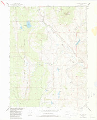
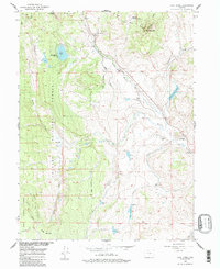
1956 Map of Lake Agnes
USGS Topo · Published 1986About this map
High mountain ranching and alpine recreation define this 1956 survey of the high country straddling Routt and Grand Counties. The landscape is dominated by the massive peaks of the Gore Range and the Rabbit Ears Range, with the Continental Divide winding through the northeastern corner. Early mid-century land use is evident in the cluster of remote homesteads and operations such as Andersons Ranch, Martin Ranch, and the De Berard Peak Ranch. Industrial activity in the timber-rich forests is marked by the Smoot Sawmill near the northern boundary. Water management for high-altitude grazing is extensive, shown through a network of elevated reservoirs including Whiteley Peak Reservoir, Basin Reservoir, and Milk Creek Reservoir, often connected by a series of ditches and an Aqueduct. Recreational development is anchored by Rabbit Ears Lodge and a nearby ski tow, signaling the area's growth as a mountain destination.
Find a feature on this map
38 named features on this map. Tap any name to fly to it.
Don’t see what you’re looking for? This feature index may not catch every label — zoom into the map to look around manually.
Map Details
Editions of this 1956 Lake Agnes Map
6 editions found
Other maps of this area

1954 · Craig
USGS Topo · 1:250,000

1956 · Rabbit Ears Peak
USGS Topo · 1:24,000

1956 · Lake Agnes
USGS Topo · 1:24,000

1956 · Kremmling
USGS Topo · 1:62,500

1956 · Spicer Peak
USGS Topo · 1:24,000

1956 · Whiteley Peak
USGS Topo · 1:24,000

1956 · Storm Mountain
USGS Topo · 1:24,000

1956 · Walton Peak
USGS Topo · 1:24,000

1956 · Gore Pass
USGS Topo · 1:62,500

1956 · Hyannis Peak
USGS Topo · 1:62,500