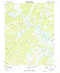
1973 Map of Lake Anna West
USGS Topo · Published 1975About this map
The North Anna River corridor underwent a massive transformation in the early 1970s, as shown by the emergence of Lake Anna behind the newly constructed dam. This survey documents the landscape just as the waters reached their operating elevation of 250 feet, flooding old stream valleys like Sturgeon Creek and Contrary Creek. The industrialization of the region is anchored by the North Anna Nuclear Powerplant, complete with its cooling lagoons, Reactors, and a prominent Radio Tower.
Find a feature on this map
32 named features on this map. Tap any name to fly to it.
Don’t see what you’re looking for? This feature index may not catch every label — zoom into the map to look around manually.
Map Details
Editions of this 1973 Lake Anna West Map
3 editions found
Other maps of this area

1887 · Spottsylvania
USGS Topo · 1:125,000

1890 · Goochland
USGS Topo · 1:125,000

1892 · Spottsylvania
USGS Topo · 1:125,000

1892 · Goochland
USGS Topo · 1:125,000

1942 · Mineral
USGS Topo · 1:31,680

1942 · Lahore
USGS Topo · 1:31,680

1942 · Partlow
USGS Topo · 1:31,680

1942 · Belmont
USGS Topo · 1:31,680

1942 · Contrary Creek
USGS Topo · 1:31,680

1942 · Brokenburg
USGS Topo · 1:31,680