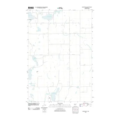
2010 Map of Lake Beauty
USGS Topo · Published 2010About this map
Beauty Lake and the nearby Lake Beauty Camp anchor this landscape in Morrison County, Minnesota, characterized by a dense concentration of glacial lakes and complex drainage patterns. The topography is defined by significant water bodies such as Thunder Lake, Pine Island Lake, and the expansive Chain of Lakes. The area is bisected by several water systems, including the South Branch Little Elk River in the north and the Spring Branch Swan River winding through the central portion. Landmarks like Tower Hill and the R Biermeier Pond Dam provide specific points of interest for local history researchers. A network of rural routes, including Lightning Pass and various county highways, connects the numerous lakefront properties and agricultural plots that define the region's mid-century character.
Find a feature on this map
40 named features on this map. Tap any name to fly to it.
Don’t see what you’re looking for? This feature index may not catch every label — zoom into the map to look around manually.
Map Details
Editions of this 2010 Lake Beauty Map
This is the sole edition of this map. No revisions or reprints were ever made.
Other maps of this area

1947 · Flensburg
USGS Topo · 1:25,000

1948 · Cushing
USGS Topo · 1:62,500

1950 · Swanville
USGS Topo · 1:62,500

1950 · Cushing
USGS Topo · 1:62,500

1951 · Flensburg
USGS Topo · 1:25,000

1953 · Brainerd
USGS Topo · 1:250,000

1953 · Saint Cloud
USGS Topo · 1:250,000

1957 · Brainerd
USGS Topo · 1:250,000

1957 · Saint Cloud
USGS Topo · 1:250,000

1958 · Saint Cloud
USGS Topo · 1:250,000