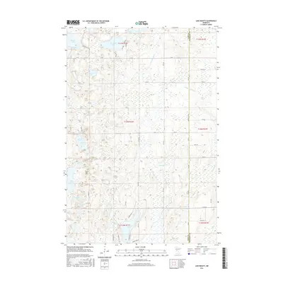
2016 Map of Lake Beauty
USGS Topo · Published 2016About this map
Beauty Lake and its surrounding wetlands anchor this glacial landscape along the border of Todd and Morrison Counties. In the mid-2010s, the region displays a high density of small water bodies and seasonal basins, including Pine Island Lake, Thunder Lake, and Loon Lake. The terrain is characterized by subtle elevation changes such as Tower Hill and the distinct pass known as Lightning Pass. The hydrological network is dominated by the wandering courses of the Little Swan River and its tributary, Spring Br Swan River, which feed into various marshy depressions like Mud Lake. Land ownership and movement are defined by a grid of county roads and local avenues, such as Co 14 and 335th Ave, which navigate around the numerous lakes and ponds that define the area's rural character.
Find a feature on this map
66 named features on this map. Tap any name to fly to it.
Don’t see what you’re looking for? This feature index may not catch every label — zoom into the map to look around manually.
Map Details
Editions of this 2016 Lake Beauty Map
This is the sole edition of this map. No revisions or reprints were ever made.
Other maps of this area

1947 · Flensburg
USGS Topo · 1:25,000

1948 · Cushing
USGS Topo · 1:62,500

1950 · Swanville
USGS Topo · 1:62,500

1950 · Cushing
USGS Topo · 1:62,500

1951 · Flensburg
USGS Topo · 1:25,000

1953 · Brainerd
USGS Topo · 1:250,000

1953 · Saint Cloud
USGS Topo · 1:250,000

1957 · Brainerd
USGS Topo · 1:250,000

1957 · Saint Cloud
USGS Topo · 1:250,000

1958 · Saint Cloud
USGS Topo · 1:250,000