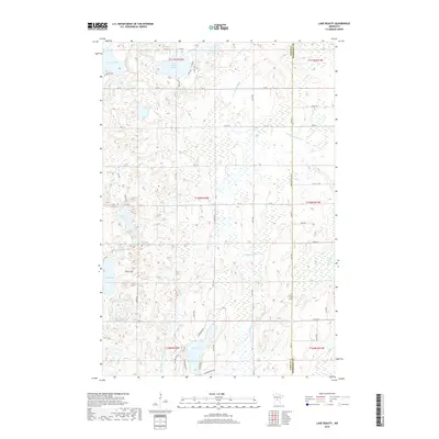
2019 Map of Lake Beauty
USGS Topo · Published 2019About this map
Beauty Lake and the surrounding wetlands of central Minnesota define this landscape along the border of Todd and Morrison counties. The terrain is characterized by a high density of water bodies and glacial features, including the Chain of Lakes and the prominent elevation of Tower Hill. This 2019 survey shows a complex hydrological network where the S Br Little Elk River and Little Swan River drain the marshy lowlands. The area is dotted with numerous small lakes like Hudalla Lake, Steinert Lake, and Pine Island Lake, many of which remain relatively inaccessible by the sparse local road network. The section lines of T130N R32W and surrounding townships reveal a rural pattern of land use, with small roads like Lightning Pass and Apron RD skirting the edges of extensive wetlands and providing access to isolated lakefronts.
Find a feature on this map
41 named features on this map. Tap any name to fly to it.
Don’t see what you’re looking for? This feature index may not catch every label — zoom into the map to look around manually.
Map Details
Editions of this 2019 Lake Beauty Map
This is the sole edition of this map. No revisions or reprints were ever made.
Other maps of this area

1947 · Flensburg
USGS Topo · 1:25,000

1948 · Cushing
USGS Topo · 1:62,500

1950 · Swanville
USGS Topo · 1:62,500

1950 · Cushing
USGS Topo · 1:62,500

1951 · Flensburg
USGS Topo · 1:25,000

1953 · Brainerd
USGS Topo · 1:250,000

1953 · Saint Cloud
USGS Topo · 1:250,000

1957 · Brainerd
USGS Topo · 1:250,000

1957 · Saint Cloud
USGS Topo · 1:250,000

1958 · Saint Cloud
USGS Topo · 1:250,000