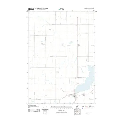
2010 Map of Lake Benton
USGS Topo · Published 2010About this map
The town of Lake Benton sits at the southwestern edge of its namesake lake, framed by the prominent highland of the Coteau des Prairies. This geographic feature dictates the local drainage, with waterways like Norwegian Creek and Medary Creek carving through the landscape. The layout of the area is defined by a rigorous grid of section roads and county highways, including County Hwy-13 and County Hwy-19, which connect isolated farmsteads to the central hub at the Lake Benton Post Office. Small-scale water management is evident at the Minnesota Noname Number 4 Dam, illustrating the intersection of prairie hydrology and rural infrastructure. The map is particularly valuable for genealogical research, documenting several distinct burial sites such as the Danish Evangelical Cemetery, Memorial Cemetery, and the Briffett Family Cemetery, reflecting the diverse settlement history of Lincoln County.
Find a feature on this map
30 named features on this map. Tap any name to fly to it.
Don’t see what you’re looking for? This feature index may not catch every label — zoom into the map to look around manually.
Map Details
Editions of this 2010 Lake Benton Map
This is the sole edition of this map. No revisions or reprints were ever made.
Other maps of this area

1953 · Watertown
USGS Topo · 1:250,000

1958 · Watertown
USGS Topo · 1:250,000

1963 · Tyler
USGS Topo · 1:24,000

1963 · Arco
USGS Topo · 1:24,000

1967 · Ruthton NW
USGS Topo · 1:24,000

1967 · Verdi
USGS Topo · 1:24,000

1967 · Lake Benton NW
USGS Topo · 1:24,000

1967 · Lake Benton
USGS Topo · 1:24,000

1967 · Lake Benton SW
USGS Topo · 1:24,000

1967 · Lake Benton NE
USGS Topo · 1:24,000