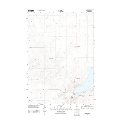
2013 Map of Lake Benton
USGS Topo · Published 2013About this map
Lake Benton sits at the base of the Coteau des Prairies, an expansive upland plateau that dominates the topography of Lincoln County. This 2013 survey illustrates a landscape defined by its glacial history, where the village and its namesake lake are surrounded by a network of rural burial sites and agricultural drainage. Several small cemeteries, including the Danish Evangelical Cem and the Briffett Family Cem, provide specific points of interest for genealogists tracing local family histories. The drainage pattern is marked by several key waterways such as Norwegian Cr and Medary Cr, which carve through the elevations of the Coteau. The intersection of Us-14 and Us-75 serves as the primary transportation hub, anchoring the residential streets of Lake Benton near the local Po.
Find a feature on this map
20 named features on this map. Tap any name to fly to it.
Don’t see what you’re looking for? This feature index may not catch every label — zoom into the map to look around manually.
Map Details
Editions of this 2013 Lake Benton Map
This is the sole edition of this map. No revisions or reprints were ever made.
Other maps of this area

1953 · Watertown
USGS Topo · 1:250,000

1958 · Watertown
USGS Topo · 1:250,000

1963 · Tyler
USGS Topo · 1:24,000

1963 · Arco
USGS Topo · 1:24,000

1967 · Ruthton NW
USGS Topo · 1:24,000

1967 · Verdi
USGS Topo · 1:24,000

1967 · Lake Benton NW
USGS Topo · 1:24,000

1967 · Lake Benton
USGS Topo · 1:24,000

1967 · Lake Benton SW
USGS Topo · 1:24,000

1967 · Lake Benton NE
USGS Topo · 1:24,000