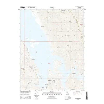
2015 Map of Lake Berryessa
USGS Topo · Published 2015About this map
Lake Berryessa dominates the western half of this landscape, its waters submerging the valley floor while leaving prominent landmarks like Big Island, Small Island, and Goat Island exposed. On the western shore, the community of Spanish Flat and the adjacent Spanish Flat Resort serve as focal points for the region's recreational development. Higher ground to the south is occupied by Berryessa Highlands and the Steel Canyon Resort, connected by local routes such as Arroyo Grande Dr and Rimrock Dr.
Find a feature on this map
49 named features on this map. Tap any name to fly to it.
Don’t see what you’re looking for? This feature index may not catch every label — zoom into the map to look around manually.
Map Details
Editions of this 2015 Lake Berryessa Map
This is the sole edition of this map. No revisions or reprints were ever made.
Other maps of this area

1902 · Napa
USGS Topo · 1:125,000

1905 · Esparto
USGS Topo · 1:24,000

1916 · Esparto
USGS Topo · 1:31,680

1921 · Mt. Vaca
USGS Topo · 1:62,500

1924 · Capay
USGS Topo · 1:62,500

1942 · Sonoma
USGS Topo · 1:62,500

1942 · Mt. Vaca
USGS Topo · 1:62,500

1942 · St. Helena
USGS Topo · 1:62,500

1943 · Capay
USGS Topo · 1:62,500

1945 · Capay
USGS Topo · 1:62,500
Featured Places
- Steel Canyon Resort, CA
- Berryessa Highlands, CA
- Spanish Flat, CA
- Spanish Flat Resort, CA
- Yolo County, CA