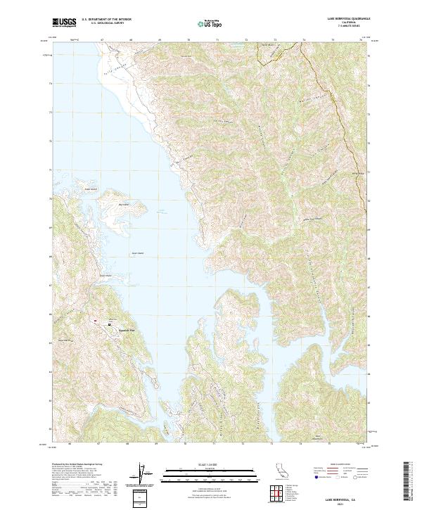
2021 Map of Lake Berryessa
USGS Topo · Published 2021About this map
Spanish Flat serves as a central point of settlement on this 2021 landscape, situated on the western shores of Lake Berryessa. The terrain is defined by a dense network of canyons and ridges, including Tully Canyon and Rocky Ridge, as the shoreline of the reservoir twists around points like Dufer Point and large landmasses such as Goat Island and Big Island. A significant historical marker is the Monticello Cem, a name that recalls the valley floor's history prior to the reservoir's creation.
Find a feature on this map
50 named features on this map. Tap any name to fly to it.
Don’t see what you’re looking for? This feature index may not catch every label — zoom into the map to look around manually.
Map Details
Editions of this 2021 Lake Berryessa Map
This is the sole edition of this map. No revisions or reprints were ever made.
Other maps of this area

1902 · Napa
USGS Topo · 1:125,000

1905 · Esparto
USGS Topo · 1:24,000

1916 · Esparto
USGS Topo · 1:31,680

1921 · Mt. Vaca
USGS Topo · 1:62,500

1924 · Capay
USGS Topo · 1:62,500

1942 · Sonoma
USGS Topo · 1:62,500

1942 · Mt. Vaca
USGS Topo · 1:62,500

1942 · St. Helena
USGS Topo · 1:62,500

1943 · Capay
USGS Topo · 1:62,500

1945 · Capay
USGS Topo · 1:62,500
Featured Places
- Spanish Flat, CA
- Steel Canyon Resort, CA
- Berryessa Highlands, CA
- Spanish Flat Resort, CA
- Yolo County, CA