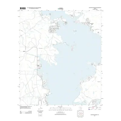
2012 Map of Lake Buchanan
USGS Topo · Published 2012About this map
Lake Buchanan dominates this landscape, its waters defining the residential and recreational patterns of northern Burnet County. The shoreline is punctuated by established communities such as Buchanan Lake Village and Silver Creek Village, where detailed street grids extend toward the water's edge. To the south, the Colorado River feeds into Inks Lake, marking a transition in the river's course. Smaller settlements like Bluffton and Golden Beach sit along the western banks, while prominent landforms like Garret Island and Rocky Point rise from the reservoir. The inclusion of the Aero-Bee Ranch Airstrip near the northeastern shore suggests the integration of private aviation into the ranching and vacation properties typical of this Central Texas region. This map illustrates the intersection of major water management infrastructure with mid-century and modern lakeside development.
Find a feature on this map
121 named features on this map. Tap any name to fly to it.
Don’t see what you’re looking for? This feature index may not catch every label — zoom into the map to look around manually.
Map Details
Editions of this 2012 Lake Buchanan Map
This is the sole edition of this map. No revisions or reprints were ever made.
Other maps of this area

1887 · Llano
USGS Topo · 1:125,000

1887 · Burnet
USGS Topo · 1:125,000

1893 · Burnet
USGS Topo · 1:125,000

1894 · Llano
USGS Topo · 1:125,000

1903 · Burnet
USGS Topo · 1:125,000

1904 · Llano
USGS Topo · 1:125,000

1909 · Llano
USGS Topo · 1:125,000

1909 · Burnet
USGS Topo · 1:125,000

1918 · Llano
USGS Topo · 1:125,000

1925 · Burnet 3-b
USGS Topo · 1:48,000