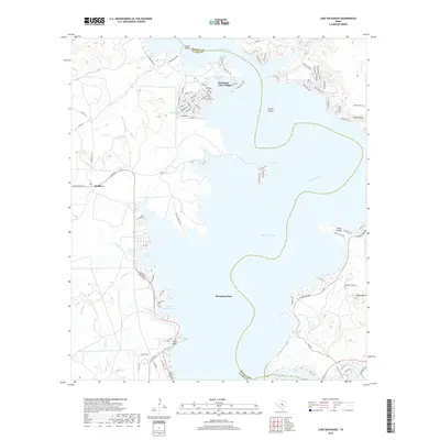
2019 Map of Lake Buchanan
USGS Topo · Published 2019About this map
Lake Buchanan dominates this central Texas landscape, where the Colorado River is harnessed by the massive Buchanan Dam along the border of Burnet and Llano counties. The settlement of Buchanan Lake Village shows a dense network of residential streets such as Lakeshore Loop and Airport Rd north of Maxwells Slough. Further west, the community of Bluffton sits near the winding course of Redrock Cr, while White Bluff occupies the eastern shore near the terminus of Ranch Rd 2341.
Find a feature on this map
97 named features on this map. Tap any name to fly to it.
Don’t see what you’re looking for? This feature index may not catch every label — zoom into the map to look around manually.
Map Details
Editions of this 2019 Lake Buchanan Map
This is the sole edition of this map. No revisions or reprints were ever made.
Other maps of this area

1887 · Llano
USGS Topo · 1:125,000

1887 · Burnet
USGS Topo · 1:125,000

1893 · Burnet
USGS Topo · 1:125,000

1894 · Llano
USGS Topo · 1:125,000

1903 · Burnet
USGS Topo · 1:125,000

1904 · Llano
USGS Topo · 1:125,000

1909 · Llano
USGS Topo · 1:125,000

1909 · Burnet
USGS Topo · 1:125,000

1918 · Llano
USGS Topo · 1:125,000

1925 · Burnet 3-b
USGS Topo · 1:48,000