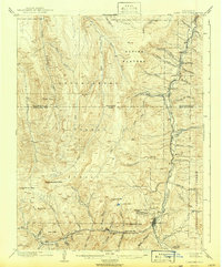
1905 Map of Lake City
USGS Topo · Published 1942About this map
Lake City serves as the focal point of this 1903 survey, situated at the confluence of several high-altitude drainages. The landscape is defined by the heavy industry of the era, particularly evident along the Lake Fork Gunnison River and Henson Creek, where the Hidden Treasure Mill and Red Rover Mill operated during the peak of regional mineral extraction. These industrial sites are linked to the wider world by the Denver and Rio Grande RR, which terminates here after passing through Kellogg Siding and following the river's narrow corridor.
Find a feature on this map
64 named features on this map. Tap any name to fly to it.
Don’t see what you’re looking for? This feature index may not catch every label — zoom into the map to look around manually.
Map Details
Editions of this 1905 Lake City Map
2 editions found
Other maps of this area

1897 · Silverton
USGS Topo · 1:62,500

1901 · Silverton
USGS Topo · 1:62,500

1902 · Silverton
USGS Topo · 1:62,500

1902 · Ouray
USGS Topo · 1:62,500

1903 · Lake City
USGS Topo · 1:62,500

1904 · Ouray
USGS Topo · 1:62,500

1905 · Lake City
USGS Topo · 1:62,500

1905 · San Cristobal
USGS Topo · 1:125,000

1907 · San Cristobal
USGS Topo · 1:125,000

1908 · Uncompahgre
USGS Topo · 1:125,000