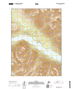
2020 Map of Lake Clark A-3 NW
USGS Topo · Published 2020About this map
Kontrashibuna Lake sits at the heart of this landscape, a long glacial water body flanked by the high peaks of the Aleutian Range. This remote portion of Lake Clark National Park is defined by sharp topographic relief, where the heights of Tanalian Mtn overlook a network of drainage systems. Small seasonal waterways like Tommy Cr and Kusma Cr carve through the steep terrain, feeding into the larger lake basin or flowing toward the southern boundary at Takoka Cr. The map captures a wilderness area almost entirely devoid of human infrastructure, focusing instead on the complex contour lines and hydrological patterns that define this section of the Lake and Peninsula Borough. The township and range lines provide the only artificial grid over a territory dominated by alpine slopes and deep freshwater basins.
Find a feature on this map
13 named features on this map. Tap any name to fly to it.
Don’t see what you’re looking for? This feature index may not catch every label — zoom into the map to look around manually.
Map Details
Editions of this 2020 Lake Clark A-3 NW Map
This is the sole edition of this map. No revisions or reprints were ever made.
Other maps of this area

1946 · Lake Clark
USGS Topo · 1:250,000

1951 · Lake Clark
USGS Topo · 1:250,000

1954 · Lake Clark A-3
USGS Topo · 1:63,360

1954 · Lake Clark B-3
USGS Topo · 1:63,360

1954 · Lake Clark A-4
USGS Topo · 1:63,360

1954 · Lake Clark B-4
USGS Topo · 1:63,360

1958 · Lake Clark
USGS Topo · 1:250,000
2018 · Lake Clark B-3 SE
USGS Topo · 1:25,000
2018 · Lake Clark A-3 NE
USGS Topo · 1:25,000
2018 · Lake Clark A-4 NE
USGS Topo · 1:25,000