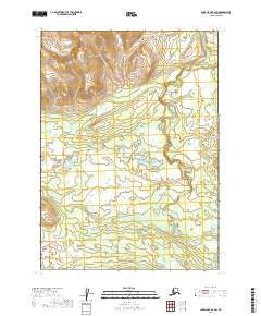
2019 Map of Lake Clark B-6 SW
USGS Topo · Published 2019About this map
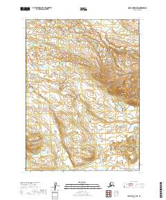
Mesa Mtn dominates the northern skyline of this Alaskan landscape, providing a high-elevation anchor for a region defined by its complex waterway network. The drainage patterns of the Koksetna River and Black Cr reveal the natural flow of the terrain through the Lake and Peninsula Borough. This map shows a wilderness area largely untouched by modern road infrastructure, where topographic contours and section lines from townships like t3n r34w and t2n r33w provide the primary framework for navigation. The presence of these specific water bodies and the prominent mesa indicates a region of significant hydrological activity, where seasonal melt and natural elevation changes dictate the character of the land.
Find a feature on this map
7 named features on this map. Tap any name to fly to it.
Don’t see what you’re looking for? This feature index may not catch every label — zoom into the map to look around manually.
Map Details
Editions of this 2019 Lake Clark B-6 SW Map
This is the sole edition of this map. No revisions or reprints were ever made.
Other maps of this area

1946 · Lake Clark
USGS Topo · 1:250,000

1951 · Lake Clark
USGS Topo · 1:250,000

1954 · Lake Clark A-7
USGS Topo · 1:63,360

1954 · Lake Clark A-6
USGS Topo · 1:63,360

1954 · Lake Clark B-6
USGS Topo · 1:63,360
1954 · Lake Clark B-7
USGS Topo · 1:63,360

1958 · Lake Clark
USGS Topo · 1:250,000
2019 · Lake Clark B-7 SE
USGS Topo · 1:25,000
2019 · Lake Clark A-6 NW
USGS Topo · 1:25,000
2019 · Lake Clark A-7 NE
USGS Topo · 1:25,000