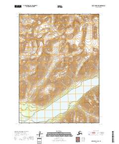
2018 Map of Lake Clark C-3 NE
USGS Topo · Published 2018About this map
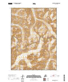
Lake Clark National Park encompasses nearly the entire landscape in this 2018 survey, reflecting a wilderness preserved by federal mandate. The most prominent geographic feature is the southern reach of Twin Lakes, a high-altitude water body that cuts through the center of the sheet. The terrain is characterized by massive elevation changes, indicated by dense contouring that rises from the lake shores toward unnamed peaks in the surrounding townships. While infrastructure is nearly non-existent in this remote area, the Teetering Rock Trail provides one of the few designated points of human access on the northern shore of the lower lake. This map captures the region in its modern state as a protected wilderness, defined by the grid of the Public Land Survey System including t7n r26w and t8n r26w.
Find a feature on this map
9 named features on this map. Tap any name to fly to it.
Don’t see what you’re looking for? This feature index may not catch every label — zoom into the map to look around manually.
Map Details
Editions of this 2018 Lake Clark C-3 NE Map
This is the sole edition of this map. No revisions or reprints were ever made.
Other maps of this area

1946 · Lake Clark
USGS Topo · 1:250,000

1951 · Lake Clark
USGS Topo · 1:250,000

1954 · Lake Clark C-3
USGS Topo · 1:63,360

1954 · Lake Clark D-3
USGS Topo · 1:63,360
1958 · Lake Clark D-2
USGS Topo · 1:63,360

1958 · Lake Clark C-2
USGS Topo · 1:63,360

1958 · Lake Clark
USGS Topo · 1:250,000
2018 · Lake Clark D-3 SE
USGS Topo · 1:25,000
2018 · Lake Clark C-3 SE
USGS Topo · 1:25,000
2018 · Lake Clark D-2 SW
USGS Topo · 1:25,000