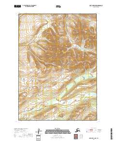
2018 Map of Lake Clark C-5 NE
USGS Topo · Published 2018About this map
The Bonanza Hills dominate this portion of the Lake and Peninsula Borough, where the terrain is defined by a dense network of high-latitude drainage systems. In this late 2010s survey, the hydrology is clearly delineated, showing the headwaters and winding paths of Ptarmigan Cr and Little Bonanza Cr as they cut through the upland topography. The map illustrates a landscape primarily organized by township and range lines, such as t7n r30w and t8n r31w, with no permanent settlements or roads indicated. This isolation emphasizes the importance of natural landmarks like Bonanza Cr and Millett Cr for navigation and location in the Alaskan interior. The absence of human infrastructure highlights the territory as it exists for surveyors and backcountry travelers, where Shunega Cr and other named waterways serve as the primary geographical anchors.
Find a feature on this map
12 named features on this map. Tap any name to fly to it.
Don’t see what you’re looking for? This feature index may not catch every label — zoom into the map to look around manually.
Map Details
Editions of this 2018 Lake Clark C-5 NE Map
This is the sole edition of this map. No revisions or reprints were ever made.
Other maps of this area

1946 · Lake Clark
USGS Topo · 1:250,000

1951 · Lake Clark
USGS Topo · 1:250,000

1954 · Lake Clark C-4
USGS Topo · 1:63,360

1954 · Lake Clark D-5
USGS Topo · 1:63,360

1954 · Lake Clark C-5
USGS Topo · 1:63,360

1954 · Lake Clark D-4
USGS Topo · 1:63,360

1958 · Lake Clark
USGS Topo · 1:250,000
2018 · Lake Clark C-4 NW
USGS Topo · 1:25,000
2018 · Lake Clark C-4 SW
USGS Topo · 1:25,000
2018 · Lake Clark C-5 NW
USGS Topo · 1:25,000