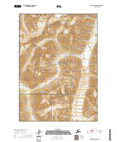
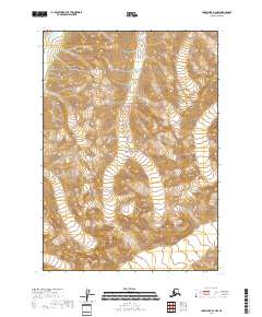
2018 Map of Lake Clark D-2 NE
USGS Topo · Published 2018About this map
Lake Clark National Park and the adjacent Lake Clark National Preserve meet at the boundary of the Kenai Peninsula Borough and Bethel Borough, defining a landscape of high alpine passes and glacial river headwaters. The topography is dominated by the Neacola River flowing through the northeastern quadrant and the Telaquana River emerging in the southwest. A critical geological and transit feature of this region is Telaquana Pass, which provides a natural corridor through the high-elevation terrain. This map captures the administrative and natural boundaries of this protected Alaskan wilderness in its 2018 configuration, highlighting the intersection of three different borough jurisdictions within the park lands.
Find a feature on this map
14 named features on this map. Tap any name to fly to it.
Don’t see what you’re looking for? This feature index may not catch every label — zoom into the map to look around manually.
Map Details
Editions of this 2018 Lake Clark D-2 NE Map
This is the sole edition of this map. No revisions or reprints were ever made.
Other maps of this area

1946 · Lake Clark
USGS Topo · 1:250,000

1951 · Lake Clark
USGS Topo · 1:250,000

1951 · Lime Hills
USGS Topo · 1:250,000

1958 · Lime Hills A-2
USGS Topo · 1:63,360
1958 · Lake Clark D-2
USGS Topo · 1:63,360
1958 · Lime Hills A-1
USGS Topo · 1:63,360
1958 · Lake Clark D-1
USGS Topo · 1:63,360

1958 · Lake Clark
USGS Topo · 1:250,000

1958 · Lime Hills
USGS Topo · 1:250,000
2018 · Lake Clark D-1 NW
USGS Topo · 1:25,000