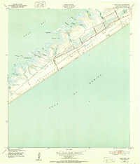
1943 Map of Lake Como
USGS Topo · Published 1952About this map
Galveston Island is depicted here during the mid-century era, defined by a series of precise numbered roadways cutting across the landscape toward the Gulf of Mexico. These routes, including Thirteenmile Road, Elevenmile Road, and Ninemile Road, provided early access to the shorelines of West Beach before the extensive modern development of the island's western end. The geography is characterized by a complex network of bays and inlets along West Bay, where named features like Eckert Bayou and Delehide Cove reach deep into the marshy interior.
Find a feature on this map
29 named features on this map. Tap any name to fly to it.
Don’t see what you’re looking for? This feature index may not catch every label — zoom into the map to look around manually.
Map Details
Editions of this 1943 Lake Como Map
2 editions found
Other maps of this area

1929 · Karankawa Lake
USGS Topo · 1:24,000

1929 · Hitchcock
USGS Topo · 1:24,000

1929 · Virginia Point
USGS Topo · 1:24,000

1930 · Galveston
USGS Topo · 1:24,000

1931 · Lake Como
USGS Topo · 1:24,000

1932 · Hitchcock
USGS Topo · 1:31,680

1932 · Virginia Point
USGS Topo · 1:31,680

1933 · Karankawa Lake
USGS Topo · 1:31,680

1933 · San Luis Pass
USGS Topo · 1:31,680
1933 · Galveston
USGS Topo · 1:31,680