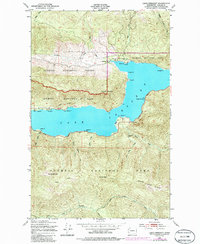
1950 Map of Lake Crescent
USGS Topo · Published 1986About this map
Lake Crescent dominates this Olympic Peninsula landscape, where steep topography meets the shoreline at points like Harrigan Pt and Saratoga Pt. In the mid-20th century, the Olympic Highway followed the southern shore, connecting small lakeside landings and recreation sites. Settlement is concentrated in small pockets such as Piedmont on the northern shore and Ovington to the west. This map captures a transition in land use, showing the boundary where the Olympic National Forest meets the Olympic National Park. High-elevation landmarks like Pyramid Mountain and Aurora Peak rise sharply from the water, while the Soleduck River Trail and Aurora Trail provide access to the backcountry. The presence of a Ranger Station near Marymere Falls and a Gravel Pit along the highway reflects the management of this protected wilderness area during its postwar development.
Find a feature on this map
37 named features on this map. Tap any name to fly to it.
Don’t see what you’re looking for? This feature index may not catch every label — zoom into the map to look around manually.
Map Details
Editions of this 1950 Lake Crescent Map
3 editions found

Other maps of this area

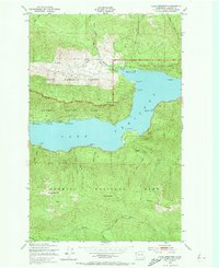
1918 · Lake Crescent
USGS Topo · 1:62,500

1919 · Port Crescent
USGS Topo · 1:62,500

1922 · Lake Crescent
USGS Topo · 1:62,500

1935 · Mount Olympus
USGS Topo · 1:62,500

1939 · Mount Tom
USGS Topo · 1:62,500

1942 · Mount Olympus
USGS Topo · 1:62,500

1950 · Mount Muller
USGS Topo · 1:24,000

1950 · Lake Sutherland
USGS Topo · 1:24,000

1950 · Twin Rivers
USGS Topo · 1:24,000
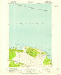
1950 · Joyce
USGS Topo · 1:24,000