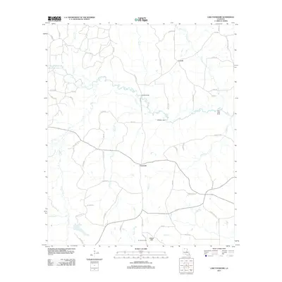
2012 Map of Lake Foursome
USGS Topo · Published 2012About this map
Bayou D'Arbonne and its many tributaries, including Sugar Cr and Indian Cr, wind through this Lincoln Parish landscape, defining the rural character of northern Louisiana in the early 21st century. The map centers on the small settlement of Crossroads, a junction point for local travel near the Alligator Hole and Petty Lake Bend. To the north, the community of Corinth sits amidst a network of timber and access roads, while Liberty Hill anchors the southern portion of the sheet. Industrial activity is evident in the presence of the Terryville Gas Field, while local family names are preserved on routes like Mays Crossing Rd and Swint Cemetery Rd. The terrain is marked by numerous small bridges and crossings, such as Brazells Bridge, which spans the complex drainage systems of the region.
Find a feature on this map
62 named features on this map. Tap any name to fly to it.
Don’t see what you’re looking for? This feature index may not catch every label — zoom into the map to look around manually.
Map Details
Editions of this 2012 Lake Foursome Map
This is the sole edition of this map. No revisions or reprints were ever made.
Other maps of this area

1950 · Ruston
USGS Topo · 1:62,500

1950 · Arcadia
USGS Topo · 1:62,500

1951 · Arcadia
USGS Topo · 1:62,500

1951 · Ruston
USGS Topo · 1:62,500

1951 · Summerfield
USGS Topo · 1:62,500

1951 · Bernice
USGS Topo · 1:62,500

1955 · Shreveport
USGS Topo · 1:250,000

1956 · Shreveport
USGS Topo · 1:250,000

1984 · Shreveport
USGS Topo · 1:250,000

1985 · Monroe North
USGS Topo · 1:100,000