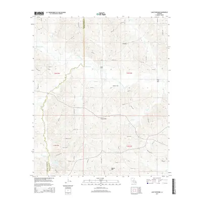
2015 Map of Lake Foursome
USGS Topo · Published 2015About this map
Bayou D'Arbonne defines the winding drainage patterns of this landscape along the border of Claiborne and Lincoln Parishes. Small agricultural and timber-linked settlements like Crossroads and Corinth sit atop the gentle rises between the numerous creeks. The northern reaches are characterized by the confluence of Sugar Creek and Fivemile Cr, while to the south, the namesake Lake Foursome serves as a local landmark. A dense network of rural roads, such as Nobles School Rd and Liberty Hill Rd, connects family lands and homesteads across the townships. One can trace the early infrastructure of the area through features like Brazells Bridge and the distinctively named Alligator Hole on the bayou, reflecting a landscape where water and wood have long dictated the pace of development.
Find a feature on this map
66 named features on this map. Tap any name to fly to it.
Don’t see what you’re looking for? This feature index may not catch every label — zoom into the map to look around manually.
Map Details
Editions of this 2015 Lake Foursome Map
This is the sole edition of this map. No revisions or reprints were ever made.
Other maps of this area

1950 · Ruston
USGS Topo · 1:62,500

1950 · Arcadia
USGS Topo · 1:62,500

1951 · Arcadia
USGS Topo · 1:62,500

1951 · Ruston
USGS Topo · 1:62,500

1951 · Summerfield
USGS Topo · 1:62,500

1951 · Bernice
USGS Topo · 1:62,500

1955 · Shreveport
USGS Topo · 1:250,000

1956 · Shreveport
USGS Topo · 1:250,000

1984 · Shreveport
USGS Topo · 1:250,000

1985 · Monroe North
USGS Topo · 1:100,000