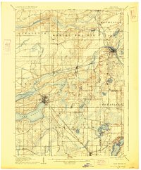
1906 Map of Lake Geneva
USGS Topo · Published 1927About this map
Lake Geneva and Lake Como anchor this late-nineteenth-century landscape, a region defined by its prominent glacial lakes and a sophisticated network of early railroads. The settlement at Lake Geneva appears as a developed center at the shoreline, while the surrounding townships of Lyons, Bloomfield, and Geneva show a dense pattern of section lines and rural homesteads. The White River and Fox River drain the eastern half of the quadrangle, passing through Burlington, where the Wisconsin Central Railroad and the Chicago Milwaukee and St. Paul Railroad intersect. This survey, conducted before the massive expansion of twentieth-century infrastructure, preserves the footprints of smaller villages like Springfield, Genoa Junction, and North Bloomfield. The mapping of Nippersink Creek and Honey Creek reveals the natural drainage patterns that dictated early road placements and farm boundaries.
Find a feature on this map
46 named features on this map. Tap any name to fly to it.
Don’t see what you’re looking for? This feature index may not catch every label — zoom into the map to look around manually.
Map Details
Editions of this 1906 Lake Geneva Map
4 editions found

Other maps of this area

1891 · Muskego
USGS Topo · 1:62,500

1892 · Whitewater
USGS Topo · 1:62,500

1892 · Eagle
USGS Topo · 1:62,500

1893 · Delavan
USGS Topo · 1:62,500

1893 · Whitewater
USGS Topo · 1:62,500

1893 · Silver Lake
USGS Topo · 1:62,500

1893 · Geneva
USGS Topo · 1:62,500

1894 · Eagle
USGS Topo · 1:62,500

1897 · Eagle
USGS Topo · 1:62,500

1901 · Muskego
USGS Topo · 1:62,500