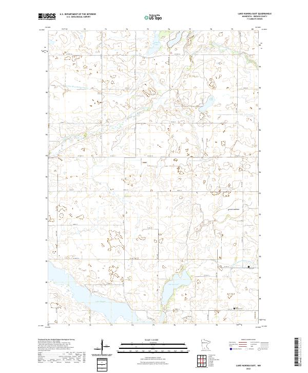
2022 Map of Lake Hanska East
USGS Topo · Published 2022About this map
Lake Hanska and Omsrud Lake dominate the southern portion of this Brown County landscape, where the agricultural grid meets a complex system of glacial basins and water management. The terrain is defined by its drainage patterns, notably the Little Cottonwood River winding through the northern sections and the industrial-scale water management of County Ditch Number Eleven and County Ditch Number Thirtyfour. These ditches represent the intensive conversion of prairie wetlands into productive farmland, a process also evident at the Broom Lakebed. For family historians, the map identifies local landmarks such as Zion Cem and Lake Hanska Cem, while smaller bodies of water like School Lake and Juni Lake provide specific geographic anchors within the townships of T109N R31W and T108N R31W.
Find a feature on this map
40 named features on this map. Tap any name to fly to it.
Don’t see what you’re looking for? This feature index may not catch every label — zoom into the map to look around manually.
Map Details
Editions of this 2022 Lake Hanska East Map
This is the sole edition of this map. No revisions or reprints were ever made.
Other maps of this area

1953 · New Ulm
USGS Topo · 1:250,000

1957 · New Ulm
USGS Topo · 1:250,000

1958 · New Ulm
USGS Topo · 1:250,000

1964 · New Ulm
USGS Topo · 1:24,000

1964 · Sleepy Eye
USGS Topo · 1:24,000

1964 · Essig
USGS Topo · 1:24,000

1965 · Madelia
USGS Topo · 1:24,000

1965 · Hanska
USGS Topo · 1:24,000

1967 · New Ulm
USGS Topo · 1:250,000

1967 · Lake Hanska West
USGS Topo · 1:24,000