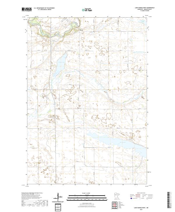
2022 Map of Lake Hanska West
USGS Topo · Published 2022About this map
Iberia stands as the primary named settlement in this pocket of Brown County, situated along a bend of the Cottonwood River in southern Minnesota. The landscape is defined by its sophisticated water management and glacial hydrology, characterized by the long, narrow reach of Lake Hanska and the organized drainage of County Ditch Number Eleven. A grid of agricultural roads, such as Co Hwy 10 and 280th Ave, connects the farmsteads that occupy the prairie between the primary river valleys. The Little Cottonwood River meanders through the central sections, while smaller bodies of water like Gilman Lake and Zanders Lake punctuate the upland plains, illustrating the transition from riparian corridors to managed farmland.
Find a feature on this map
39 named features on this map. Tap any name to fly to it.
Don’t see what you’re looking for? This feature index may not catch every label — zoom into the map to look around manually.
Map Details
Editions of this 2022 Lake Hanska West Map
This is the sole edition of this map. No revisions or reprints were ever made.
Other maps of this area

1953 · Morgan
USGS Topo · 1:62,500

1953 · New Ulm
USGS Topo · 1:250,000

1957 · New Ulm
USGS Topo · 1:250,000

1958 · New Ulm
USGS Topo · 1:250,000

1964 · Sleepy Eye
USGS Topo · 1:24,000

1964 · Essig
USGS Topo · 1:24,000

1967 · New Ulm
USGS Topo · 1:250,000

1967 · Lake Hanska West
USGS Topo · 1:24,000

1967 · Godahl
USGS Topo · 1:24,000

1967 · Darfur
USGS Topo · 1:24,000