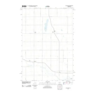
2010 Map of Lake Henry
USGS Topo · Published 2010About this map
The North Fork Crow River meanders across the southern portion of this landscape, anchoring a region defined by agricultural plots and quiet settlements at the start of the 21st century. The village of Regal sits near the river's path, while the community of Lake Henry is positioned further north, adjacent to the lake of the same name. This survey highlights the local prominence of parish life and genealogy, documenting several burial grounds including Saint Paul's Lutheran Cemetery, Saint Margaret Cemetery, and Saint Anthony Cemetery. A precise grid of county roads, such as County Hwy-129 and County Line Rd, structures the movement between these small centers and the outlying farmsteads, reflecting a long-established pattern of rural Stearns County life.
Find a feature on this map
37 named features on this map. Tap any name to fly to it.
Don’t see what you’re looking for? This feature index may not catch every label — zoom into the map to look around manually.
Map Details
Editions of this 2010 Lake Henry Map
This is the sole edition of this map. No revisions or reprints were ever made.
Other maps of this area

1953 · Saint Cloud
USGS Topo · 1:250,000

1957 · Saint Cloud
USGS Topo · 1:250,000

1958 · Saint Cloud
USGS Topo · 1:250,000

1965 · Greenwald
USGS Topo · 1:24,000

1965 · Elrosa
USGS Topo · 1:24,000

1965 · St Martin
USGS Topo · 1:24,000

1967 · Paynesville
USGS Topo · 1:24,000

1967 · Lake Koronis
USGS Topo · 1:24,000
1967 · Georgeville
USGS Topo · 1:24,000

1967 · Hawick
USGS Topo · 1:24,000