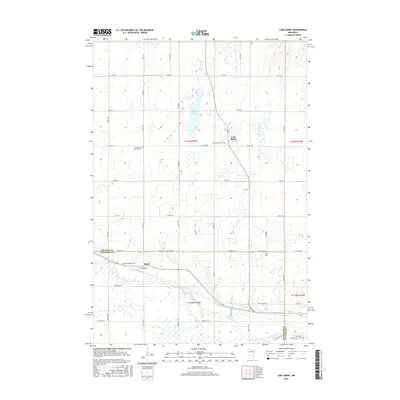
2016 Map of Lake Henry
USGS Topo · Published 2016About this map
The small settlement of Lake Henry serves as a central point for this 2016 survey of central Minnesota, situated just north of the border between Stearns Co and Kandiyohi Co. The landscape is characterized by a series of significant cemeteries, including Saint Margaret Cem, Saint Paul's Lutheran Cem, and Saint Anthony Cem, which reflect the region's enduring rural parish communities and deep-rooted genealogy.
Find a feature on this map
51 named features on this map. Tap any name to fly to it.
Don’t see what you’re looking for? This feature index may not catch every label — zoom into the map to look around manually.
Map Details
Editions of this 2016 Lake Henry Map
This is the sole edition of this map. No revisions or reprints were ever made.
Other maps of this area

1953 · Saint Cloud
USGS Topo · 1:250,000

1957 · Saint Cloud
USGS Topo · 1:250,000

1958 · Saint Cloud
USGS Topo · 1:250,000

1965 · Greenwald
USGS Topo · 1:24,000

1965 · Elrosa
USGS Topo · 1:24,000

1965 · St Martin
USGS Topo · 1:24,000

1967 · Paynesville
USGS Topo · 1:24,000

1967 · Lake Koronis
USGS Topo · 1:24,000
1967 · Georgeville
USGS Topo · 1:24,000

1967 · Hawick
USGS Topo · 1:24,000