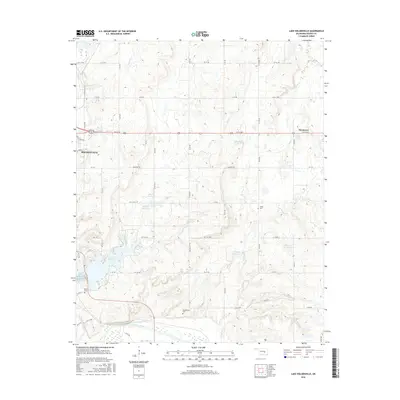
2016 Map of Lake Holdenville
USGS Topo · Published 2016About this map
Holdenville and the surrounding Hughes County landscape are defined by the convergence of the Canadian River and the significant reservoirs of the central Oklahoma plains. This survey documents the area's complex water management system, centered on Lake Holdenville and Holdenville City Lake, alongside several numbered reservoirs such as 063021 Reservoir. The terrain is characterized by numerous small tributaries including Tiger Cr, Elm Cr, and Grief Cr that drain toward the Canadian River. Local history is anchored by rural landmarks such as Horntown and a series of burial grounds that include Shiloh Cem, Glory Cem, and Stubblefield Cem. The grid of section roads like ew133 RD and fragments of Old US Hwy 270 illustrate the transportation network connecting these small settlements and agricultural tracts.
Find a feature on this map
44 named features on this map. Tap any name to fly to it.
Don’t see what you’re looking for? This feature index may not catch every label — zoom into the map to look around manually.
Map Details
Editions of this 2016 Lake Holdenville Map
This is the sole edition of this map. No revisions or reprints were ever made.
Other maps of this area

1896 · Coalgate
USGS Topo · 1:125,000

1899 · Coalgate
USGS Topo · 1:125,000

1900 · Wewoka
USGS Topo · 1:125,000

1900 · Coalgate
USGS Topo · 1:125,000

1954 · Oklahoma City
USGS Topo · 1:250,000

1957 · Ardmore
USGS Topo · 1:250,000

1957 · Oklahoma City
USGS Topo · 1:250,000

1963 · Ardmore
USGS Topo · 1:250,000

1963 · Oklahoma City
USGS Topo · 1:250,000

1967 · Calvin East
USGS Topo · 1:24,000