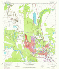
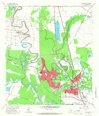
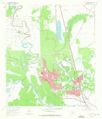
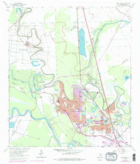
1963 Map of Lake Jackson
USGS Topo · Published 1977About this map
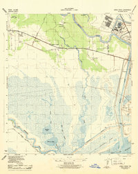
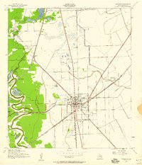
The Brazos River and its ancient meanders define this coastal Texas landscape as it appeared in the mid-1970s. The urban centers of Lake Jackson and Clute show significant development, with established residential grids and community institutions like St Michaels Ch, Beutel Sch, and the Restwood Memorial Park. The influence of the Texas prison system is clearly marked by the Department of Correction (Retrieve Unit) and the Clemens Unit situated along the river's fertile bends.
Find a feature on this map
65 named features on this map. Tap any name to fly to it.
Don’t see what you’re looking for? This feature index may not catch every label — zoom into the map to look around manually.
Map Details
Editions of this 1963 Lake Jackson Map
4 editions found
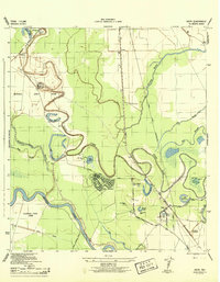
Other maps of this area
1943 · Oyster Creek
USGS Topo · 1:31,680
1943 · Jones Creek
USGS Topo · 1:31,680
1943 · Danbury
USGS Topo · 1:31,680
1943 · Freeport
USGS Topo · 1:31,680
1943 · Angleton
USGS Topo · 1:24,000
1943 · Snipe
USGS Topo · 1:31,680

1950 · Houston
USGS Topo · 1:250,000

1951 · Bay City
USGS Topo · 1:250,000
1952 · Cedar Lane NE
USGS Topo · 1:24,000
1952 · East Columbia
USGS Topo · 1:24,000