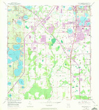
1953 Map of Lake Jessamine
USGS Topo · Published 1972About this map
Big Sand Lake and its surrounding wetlands dominate the western landscape of this Orange County region, illustrating the transition from natural citrus-era hydrology to mid-century suburban expansion. The 1970 photo-revisions highlight the rapid growth of communities like Tangelo Park and Sky Lake, appearing as purple-tinted urban extensions against the original 1953 survey. The infrastructure of the era is clearly marked by the Florida's Turnpike Toll Road cutting across the center, supported by a network of tollgates and substations.
Find a feature on this map
36 named features on this map. Tap any name to fly to it.
Don’t see what you’re looking for? This feature index may not catch every label — zoom into the map to look around manually.
Map Details
Editions of this 1953 Lake Jessamine Map
5 editions found
Other maps of this area

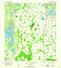
1953 · Lake Jessamine
USGS Topo · 1:24,000

1953 · St Cloud North
USGS Topo · 1:24,000

1953 · Pine Castle
USGS Topo · 1:24,000

1953 · Kissimmee
USGS Topo · 1:24,000

1953 · Windermere
USGS Topo · 1:24,000

1953 · Intercession City
USGS Topo · 1:24,000

1955 · Orlando
USGS Topo · 1:250,000

1956 · Winter Garden
USGS Topo · 1:24,000

1956 · Orlando West
USGS Topo · 1:24,000

1956 · Orlando East
USGS Topo · 1:24,000