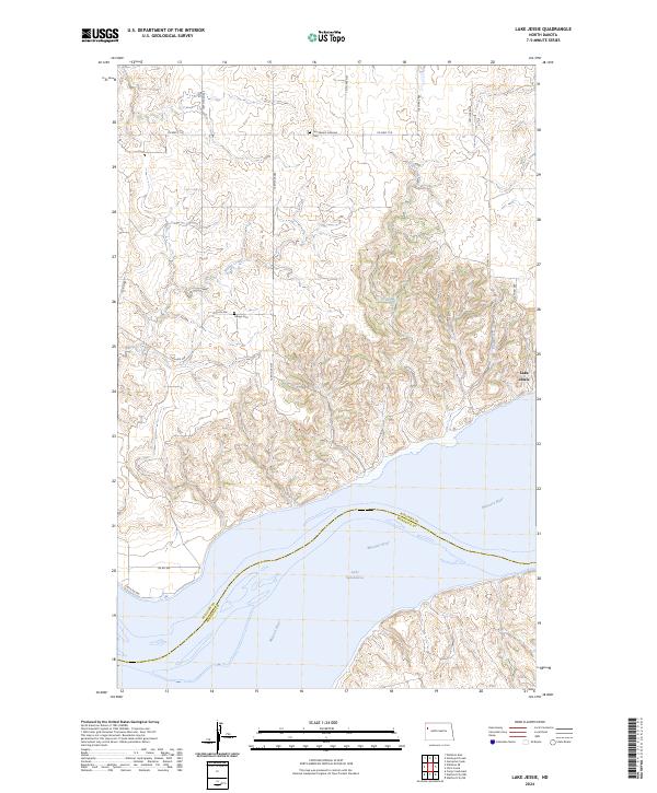
2024 Map of Lake Jessie
USGS Topo · Published 2024About this map
Missouri River and its expansive modern impoundment, Lake Sakakawea, dominate the southern reach of this landscape along the boundary of Williams and McKenzie counties. The terrain to the north is defined by a series of drainage systems, including Willow Creek, Cedar Creek, and Plum Creek, which carve through the high ground before reaching the river valley. The map documents the persistent rural character of the region, where section-line roads like 128th Ave NW and Co Hwy 11 A connect remote homesteads and local landmarks. Genealogists will find the locations of Our Saviors Lutheran Cem and Hauge Cem particularly valuable for tracing early families in this part of North Dakota. To the east, the small water body of Lake Jessie sits near the edge of the dissected uplands overlooking the Missouri.
Find a feature on this map
26 named features on this map. Tap any name to fly to it.
Don’t see what you’re looking for? This feature index may not catch every label — zoom into the map to look around manually.
Map Details
Editions of this 2024 Lake Jessie Map
This is the sole edition of this map. No revisions or reprints were ever made.
Other maps of this area

1911 · Ray
USGS Topo · 1:125,000

1953 · Williston
USGS Topo · 1:250,000

1953 · Watford City
USGS Topo · 1:250,000

1957 · Williston
USGS Topo · 1:250,000

1957 · Watford City
USGS Topo · 1:250,000

1959 · Williston East
USGS Topo · 1:24,000

1967 · Watford City
USGS Topo · 1:250,000

1978 · Lake Jessie
USGS Topo · 1:24,000

1978 · Watford City NW
USGS Topo · 1:24,000
1978 · Camp Creek East
USGS Topo · 1:24,000