
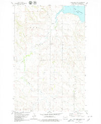
1978 Map of Lake Jessie
USGS Topo · Published 1978About this map
Lake Sakakawea and the Missouri River define the southern portion of this landscape, marking the border between Williams and McKenzie Counties. The terrain shifts from the river valley and the Badlands to the north into the upland drainage of Twelve Mile, where Willow Creek, Cedar Creek, and Plum Creek cut through the prairie. This 1970s record shows a sparse rural settlement pattern focused around local institutions like Our Savior Ch, Hauge Ch, and a lone Cem northwest of Lake Jessie. The presence of a Scoria Pit and Gravel Pit indicates localized resource extraction, while Radio Towers along the northern boundary reflect mid-century infrastructure reaching these remote townships.
Find a feature on this map
16 named features on this map. Tap any name to fly to it.
Don’t see what you’re looking for? This feature index may not catch every label — zoom into the map to look around manually.
Map Details
Editions of this 1978 Lake Jessie Map
This is the sole edition of this map. No revisions or reprints were ever made.
Other maps of this area

1911 · Ray
USGS Topo · 1:125,000

1953 · Williston
USGS Topo · 1:250,000

1953 · Watford City
USGS Topo · 1:250,000

1957 · Williston
USGS Topo · 1:250,000

1957 · Watford City
USGS Topo · 1:250,000

1959 · Williston East
USGS Topo · 1:24,000

1967 · Watford City
USGS Topo · 1:250,000

1978 · Watford City NW
USGS Topo · 1:24,000
1978 · Camp Creek East
USGS Topo · 1:24,000

1978 · Watford City NE
USGS Topo · 1:24,000