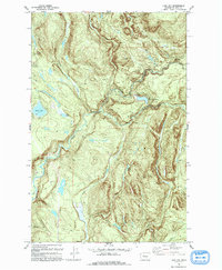
1993 Map of Lake Joy
USGS Topo · Published 1993About this map
Lake Joy and Moss Lake anchor this 1993 study of the King County landscape, reflecting the hydrological complexities of the Snoqualmie Valley fringe. The confluence of the North Fork Tolt River and South Fork Tolt River dominates the central terrain, feeding into the Tolt Regulating Basin. This area is characterized by an extensive network of drainage including Strossel Creek and Harris Creek, highlighting the region's reliance on these water systems for local utility and resource management.
Find a feature on this map
14 named features on this map. Tap any name to fly to it.
Don’t see what you’re looking for? This feature index may not catch every label — zoom into the map to look around manually.
Map Details
Editions of this 1993 Lake Joy Map
This is the sole edition of this map. No revisions or reprints were ever made.
Other maps of this area

1921 · Sultan
USGS Topo · 1:125,000

1923 · Sultan
USGS Topo · 1:125,000

1953 · Snoqualmie
USGS Topo · 1:24,000

1953 · Sultan
USGS Topo · 1:24,000

1953 · Lake Joy
USGS Topo · 1:24,000

1953 · Monroe
USGS Topo · 1:24,000

1953 · Fall City
USGS Topo · 1:24,000

1953 · Carnation
USGS Topo · 1:24,000

1956 · Monroe
USGS Topo · 1:62,500

1957 · Index
USGS Topo · 1:62,500