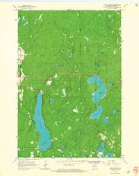
1965 Map of Lake Lucerne
USGS Topo · Published 1967About this map
Sugarbush Hill stands as a prominent high point in this mid-1960s survey of the Nicolet National Forest, situated north of the expansive Lake Lucerne. The map reveals a landscape defined by glacial topography and an intricate drainage system including Otter Creek and the Indian River. Large water bodies like Wabikon Lake and Riley Lake dominate the eastern half, while smaller features like Johnson Springs and Indian Springs dot the forest floor. A Lookout Tower and Radio Tower atop the hills suggest the area's importance for forest management and communication. Settlement is sparse, characterized by a Boy Scout Camp near Hardwood Lake and scattered Gravel Pit operations, reflecting a region primarily dedicated to timber, recreation, and conservation within the Lincoln and Argonne townships.
Find a feature on this map
35 named features on this map. Tap any name to fly to it.
Don’t see what you’re looking for? This feature index may not catch every label — zoom into the map to look around manually.
Map Details
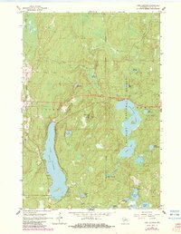
Editions of this 1965 Lake Lucerne Map
2 editions found
Other maps of this area

1939 · Crandon
USGS Topo · 1:48,000

1939 · Laona
USGS Topo · 1:48,000

1941 · Crandon
USGS Topo · 1:48,000

1942 · Wabeno
USGS Topo · 1:48,000

1942 · Pearson
USGS Topo · 1:48,000

1946 · Laona
USGS Topo · 1:48,000

1947 · Crandon
USGS Topo · 1:48,000

1950 · Wabeno
USGS Topo · 1:48,000

1950 · Lily
USGS Topo · 1:48,000

1951 · Wabeno
USGS Topo · 1:48,000