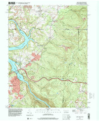
1997 Map of Lake Lynn
USGS Topo · Published 2000About this map
The Cheat River and Cheat Lake serve as the central geographic features for this late 1990s topographic study, marking the border between Fayette County, Pennsylvania, and Monongalia County, West Virginia. The landscape is a study in industrial and recreational transitions, showing the Power Station near the lake's northern end alongside extensive Strip Mines at Grassy Run. To the south and east, the map detail shifts toward protected lands and heritage sites, including the expansive Coopers Rock State Forest and the historical Clay Furnace.
Find a feature on this map
69 named features on this map. Tap any name to fly to it.
Don’t see what you’re looking for? This feature index may not catch every label — zoom into the map to look around manually.
Map Details
Editions of this 1997 Lake Lynn Map
2 editions found
Other maps of this area

1900 · Uniontown
USGS Topo · 1:62,500

1900 · Masontown
USGS Topo · 1:62,500

1902 · Morgantown
USGS Topo · 1:62,500

1903 · Masontown
USGS Topo · 1:62,500

1904 · Bruceton
USGS Topo · 1:62,500

1925 · Morgantown
USGS Topo · 1:62,500

1926 · Bruceton
USGS Topo · 1:62,500

1931 · Uniontown
USGS Topo · 1:62,500

1931 · Masontown
USGS Topo · 1:62,500

1931 · Bruceton Mills
USGS Topo · 1:62,500