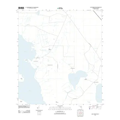
2012 Map of Lake Marian NW
USGS Topo · Published 2012About this map
The eastern shores of Lake Kissimmee reveal a landscape defined by expansive wetlands and isolated rises in Osceola County. This 2012 survey documents a series of "hammocks"—islands of hardwood vegetation or slightly higher ground—that punctuate the surrounding marshy terrain. Named features such as Orange Hammock, Camp Hammock, and Sailor Hammock suggest historically significant dry-ground sites within the wet prairie system. To the east, Lake Jackson and the northern tip of Lake Marian anchor a network of drainage features including Jackson Canal, Parker Slough, and Fodderstack Slough. The distribution of these hammocks and sloughs, connected by rural routes like Joe Overstreet Rd and Prairie Lakes Rd, illustrates the traditional cattle ranching and wilderness character of this interior Florida region. Significant island features like Ox Island, Bird Island, and the northern edge of Brahma Island mark the boundary between open water and the diverse scrublands to the east.
Find a feature on this map
22 named features on this map. Tap any name to fly to it.
Don’t see what you’re looking for? This feature index may not catch every label — zoom into the map to look around manually.
Map Details
Editions of this 2012 Lake Marian NW Map
This is the sole edition of this map. No revisions or reprints were ever made.
Other maps of this area

1952 · Lake Weohyakapka SE
USGS Topo · 1:24,000

1952 · Lake Weohyakapka NE
USGS Topo · 1:24,000

1953 · Lake Marian NW
USGS Topo · 1:24,000

1953 · Cypress Lake
USGS Topo · 1:24,000

1953 · Lake Marian SE
USGS Topo · 1:24,000

1953 · Holopaw SE
USGS Topo · 1:24,000

1953 · Lake Marian SW
USGS Topo · 1:24,000

1953 · Holopaw SW
USGS Topo · 1:24,000

1953 · Lake Marian NE
USGS Topo · 1:24,000

1955 · Orlando
USGS Topo · 1:250,000