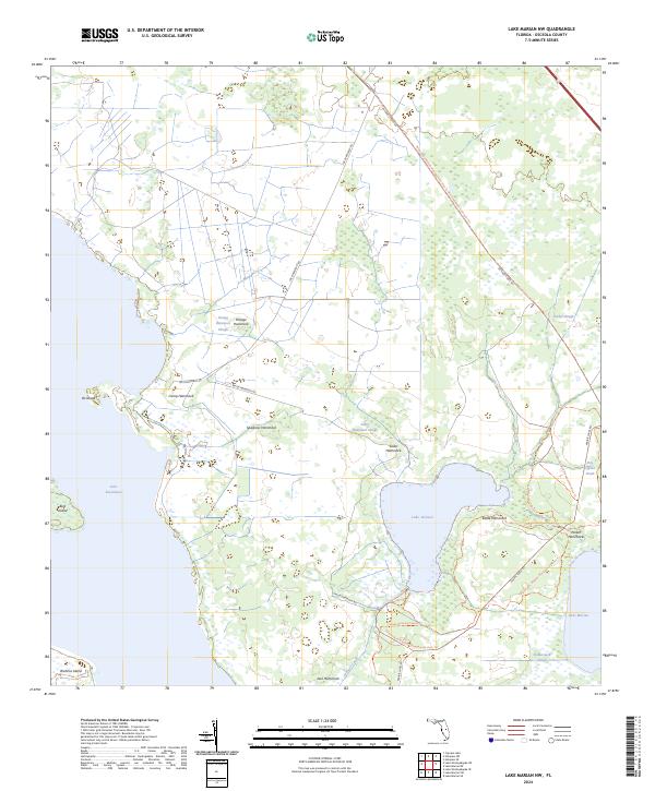
2024 Map of Lake Marian NW
USGS Topo · Published 2024About this map
Lake Jackson and the surrounding marshlands of Osceola County dominate this modern landscape, where the waters of Lake Kissimmee reach the western edge of the quadrangle. The map detail reflects a region defined by its conservation status, primarily within the Three Lakes Wildlife Management Area. Numerous "hammocks"—islands of hardwood vegetation in the prairie—are identified by name, including Sawgrass Hammock and Kettle Hammock, which provide critical waypoints for local history. Settlement is sparse, represented by Camp Hammock and remote access roads like Joe Overstreet Rd.
Find a feature on this map
33 named features on this map. Tap any name to fly to it.
Don’t see what you’re looking for? This feature index may not catch every label — zoom into the map to look around manually.
Map Details
Editions of this 2024 Lake Marian NW Map
This is the sole edition of this map. No revisions or reprints were ever made.
Other maps of this area

1952 · Lake Weohyakapka SE
USGS Topo · 1:24,000

1952 · Lake Weohyakapka NE
USGS Topo · 1:24,000

1953 · Lake Marian NW
USGS Topo · 1:24,000

1953 · Cypress Lake
USGS Topo · 1:24,000

1953 · Lake Marian SE
USGS Topo · 1:24,000

1953 · Holopaw SE
USGS Topo · 1:24,000

1953 · Lake Marian SW
USGS Topo · 1:24,000

1953 · Holopaw SW
USGS Topo · 1:24,000

1953 · Lake Marian NE
USGS Topo · 1:24,000

1955 · Orlando
USGS Topo · 1:250,000