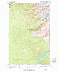
1968 Map of Lake Mc Donald East
USGS Topo · Published 1988About this map
Mt Brown Lookout stands as a sentinel over this section of Glacier National Park during the late 1960s, a landscape defined by its network of backcountry trails and high-altitude alpine basins. The map highlights the essential infrastructure of early mountain tourism and park management, including the Sperry Chalets and several Patrol Cabins strategically placed for backcountry oversight. Water systems are prominent, ranging from the vast expanse of Lake McDonald to specialized facilities like the Sewage Disposal area near the lakeshore.
Find a feature on this map
33 named features on this map. Tap any name to fly to it.
Don’t see what you’re looking for? This feature index may not catch every label — zoom into the map to look around manually.
Map Details
Editions of this 1968 Lake Mc Donald East Map
2 editions found
Other maps of this area

1904 · Chief Mountain
USGS Topo · 1:125,000

1914 · Nyack
USGS Topo · 1:125,000

1938 · Chief Mountain
USGS Topo · 1:125,000

1960 · Cut Bank
USGS Topo · 1:250,000

1963 · Cut Bank
USGS Topo · 1:250,000

1964 · Cut Bank
USGS Topo · 1:250,000

1964 · Nyack
USGS Topo · 1:24,000

1964 · Stanton Lake
USGS Topo · 1:24,000
1964 · West Glacier
USGS Topo · 1:24,000
1968 · Lake Mc Donald West
USGS Topo · 1:24,000