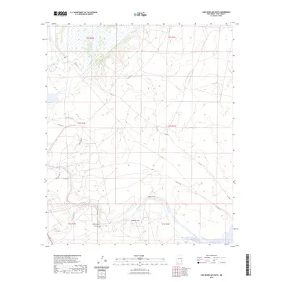
2023 Map of Lake McMillan South
USGS Topo · Published 2023About this map
The Pecos River carves a winding path through this arid Eddy County landscape, defining the topography of the region. Distinctive geological drainage patterns are evident through named features like Dagger Draw and Soapberry Draw, which channel runoff toward the river. Near the sharp river curve at Adams Bend, the map reveals the intersection of natural watercourses and modern infrastructure. Roadways such as N Lake Rd and High Noon Rd navigate the undulating terrain, providing access to remote sections of the Pecos Valley. The presence of Rocky Arroyo and Spencer Draw further illustrates the complex watershed system that has shaped this part of New Mexico, offering a detailed look at the land's transition from high desert draws to the riparian corridor of the main river.
Find a feature on this map
19 named features on this map. Tap any name to fly to it.
Don’t see what you’re looking for? This feature index may not catch every label — zoom into the map to look around manually.
Map Details
Editions of this 2023 Lake McMillan South Map
This is the sole edition of this map. No revisions or reprints were ever made.
Other maps of this area

1939 · Carlsbad
USGS Topo · 1:62,500

1943 · Carlsbad
USGS Topo · 1:62,500

1943 · Oil City
USGS Topo · 1:62,500

1943 · West Carlsbad
USGS Topo · 1:62,500

1945 · West Carlsbad
USGS Topo · 1:62,500

1954 · Seven Rivers
USGS Topo · 1:24,000

1954 · Carlsbad
USGS Topo · 1:250,000

1955 · Dayton
USGS Topo · 1:24,000

1955 · Lake Mc Millan North
USGS Topo · 1:24,000

1955 · Lake Mc Millan South
USGS Topo · 1:24,000