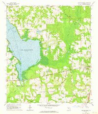
1963 Map of Lake Miccosukee
USGS Topo · Published 1964About this map
Lake Miccosukee dominates the western portion of this mid-century landscape, acting as a natural divider between Leon and Jefferson counties. The shoreline is punctuated by distinct landmarks such as Pine Island and Live Oak Point, while a managed Boat Channel facilitates navigation through the marshy waters. To the east, the seat of local activity centers on Monticello, where the Atlantic Coast Line Railroad and a nearby Airport reflect the era's transportation infrastructure.
Find a feature on this map
35 named features on this map. Tap any name to fly to it.
Don’t see what you’re looking for? This feature index may not catch every label — zoom into the map to look around manually.
Map Details
Editions of this 1963 Lake Miccosukee Map
2 editions found
Other maps of this area

1954 · Lloyd
USGS Topo · 1:24,000

1954 · Valdosta
USGS Topo · 1:250,000

1954 · Tallahassee
USGS Topo · 1:250,000

1955 · Lamont
USGS Topo · 1:24,000

1955 · Waukeenah
USGS Topo · 1:24,000

1956 · Monticello NE
USGS Topo · 1:24,000

1956 · Metcalf
USGS Topo · 1:24,000

1957 · Miccosukee NE
USGS Topo · 1:24,000

1958 · Valdosta
USGS Topo · 1:250,000

1959 · Tallahassee
USGS Topo · 1:250,000