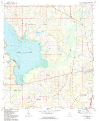
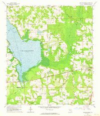
1963 Map of Lake Miccosukee
USGS Topo · Published 1993About this map
Lake Miccosukee dominates the western half of this Florida landscape, with a clearly defined Boat Channel cutting through its marshy waters toward various landings. The eastern portion transitions into a network of small settlements and agricultural sites like Monticello and Montivilla. Scattered throughout the rural landscape are numerous country churches that served as local anchors, including Sweetfield Church, Mt Olive Ch, and Juniors Hill Ch. An Old Railroad Grade traces a path through the northeastern corner near Alma, indicating a shift in the local transportation network. The boundary between Jefferson and Leon counties bisects the lake, while landmarks such as the Lookout Tower near Casa Blanco and a Roadside Park along the southern highway suggest a mid-century infrastructure designed for both utility and travel.
Find a feature on this map
35 named features on this map. Tap any name to fly to it.
Don’t see what you’re looking for? This feature index may not catch every label — zoom into the map to look around manually.
Map Details
Editions of this 1963 Lake Miccosukee Map
2 editions found
Other maps of this area

1954 · Lloyd
USGS Topo · 1:24,000

1954 · Valdosta
USGS Topo · 1:250,000

1954 · Tallahassee
USGS Topo · 1:250,000

1955 · Lamont
USGS Topo · 1:24,000

1955 · Waukeenah
USGS Topo · 1:24,000

1956 · Monticello NE
USGS Topo · 1:24,000

1956 · Metcalf
USGS Topo · 1:24,000

1957 · Miccosukee NE
USGS Topo · 1:24,000

1958 · Valdosta
USGS Topo · 1:250,000

1959 · Tallahassee
USGS Topo · 1:250,000