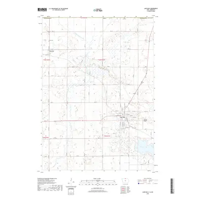
2018 Map of Lake Mills
USGS Topo · Published 2018About this map
Lake Mills serves as the primary hub in this northern Winnebago County landscape, where the grid of agricultural roads meets the winding course of Lime Creek. The town's layout is documented down to specific street names like W Main St and Milton Ave S, alongside the Lake Mills Municipal Airport. To the northwest, the smaller settlement of Scarville sits near the Minnesota border, surrounded by a dense network of drainage infrastructure like Drainage Ditch Number 108, which transformed these prairie wetlands into productive farmland. For genealogists, the map is particularly detailed, pinpointing numerous burial sites including Sunnyside Cem, Salem Memorial Cem, and Immanuel Cem. The southeastern corner is dominated by the waters of Rice Lake, providing a natural contrast to the surveyed townships and range lines that define the region's rural character.
Find a feature on this map
69 named features on this map. Tap any name to fly to it.
Don’t see what you’re looking for? This feature index may not catch every label — zoom into the map to look around manually.
Map Details
Editions of this 2018 Lake Mills Map
This is the sole edition of this map. No revisions or reprints were ever made.
Other maps of this area

1954 · Albert Lea
USGS Topo · 1:62,500

1954 · Mason City
USGS Topo · 1:250,000

1955 · Wells
USGS Topo · 1:62,500

1957 · Mason City
USGS Topo · 1:250,000

1958 · Mason City
USGS Topo · 1:250,000

1972 · Forest City
USGS Topo · 1:24,000

1972 · Fertile
USGS Topo · 1:24,000

1972 · Bristol
USGS Topo · 1:24,000

1972 · Pilot Knob
USGS Topo · 1:24,000

1972 · Vinje
USGS Topo · 1:24,000