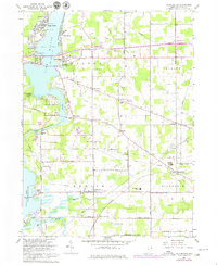
1966 Map of Lake Milton
USGS Topo · Published 1980About this map
Lake Milton and the Mahoning River corridor define this part of Mahoning County during a period of recreational and residential development. The landscape is a mix of lakeside leisure and established rural crossroads, where the Amusement Park at Craig Beach stands in contrast to the numerous family-named junctions such as Schrader Corners, Heiser Corners, and Helsel Corners. This era shows the expansion of lakeside communities alongside older agricultural hubs like Berlin Center and Rosemont.
Find a feature on this map
66 named features on this map. Tap any name to fly to it.
Don’t see what you’re looking for? This feature index may not catch every label — zoom into the map to look around manually.
Map Details
Editions of this 1966 Lake Milton Map
2 editions found
Other maps of this area

1906 · Ravenna
USGS Topo · 1:62,500

1908 · Warren
USGS Topo · 1:62,500

1908 · Ravenna
USGS Topo · 1:62,500

1909 · Alliance
USGS Topo · 1:62,500

1909 · Lisbon
USGS Topo · 1:62,500

1950 · Cleveland
USGS Topo · 1:250,000

1951 · Canton
USGS Topo · 1:250,000

1952 · Lake Milton
USGS Topo · 1:24,000

1952 · Canfield
USGS Topo · 1:24,000

1952 · Alliance
USGS Topo · 1:24,000